MENU
  • Home
  • Latest News & Reports
    • January
    • 2022
      • December
      • November
      • October
      • September
      • August
      • July
      • June
      • May
      • April
      • March
      • February
      • January
    • 2021
      • December
      • November
      • October
      • September
      • August
      • July
      • June
      • May
      • April
      • March
      • February
      • January
    • 2020
      • December
      • November
      • October
      • September
      • August
      • July
      • June
      • May
      • April
      • March
      • February
      • January
    • 2019
      • December
      • November
      • October
      • September
      • August
      • July
      • June
      • May
      • April
      • March
      • February
      • January
    • 2018
      • December
  • Guided Walks
  • History
  • Restoration
  • Location
  • Features
    • Sea Lock
    • Ridd Inclined Plane
    • Beam Aqueduct
    • Furzebeam
    • Staple Vale & the Rolle Road
    • New Town Mills
    • Rosemoor
    • Tucking Mill
    • Darkham Weir
  • Galleries
    • Sea Lock
    • Ridd Inclined Plane
    • Beam Aqueduct
    • Furzebeam
    • Rolle Road
    • Rosemoor and Darkham Weir
  • Other North Devon Waterways
  • Archive
    • Old Newsletters
    • Photos
    • Maps
    • Newspaper Clippings
  • Restoration of the Middle Basin at Sea Lock
  • Join the Society
  • Contacts

Maps

Old maps of the canal...
Picture
A map drawn by James Green showing a proposed new road from Torrington to Beaford.

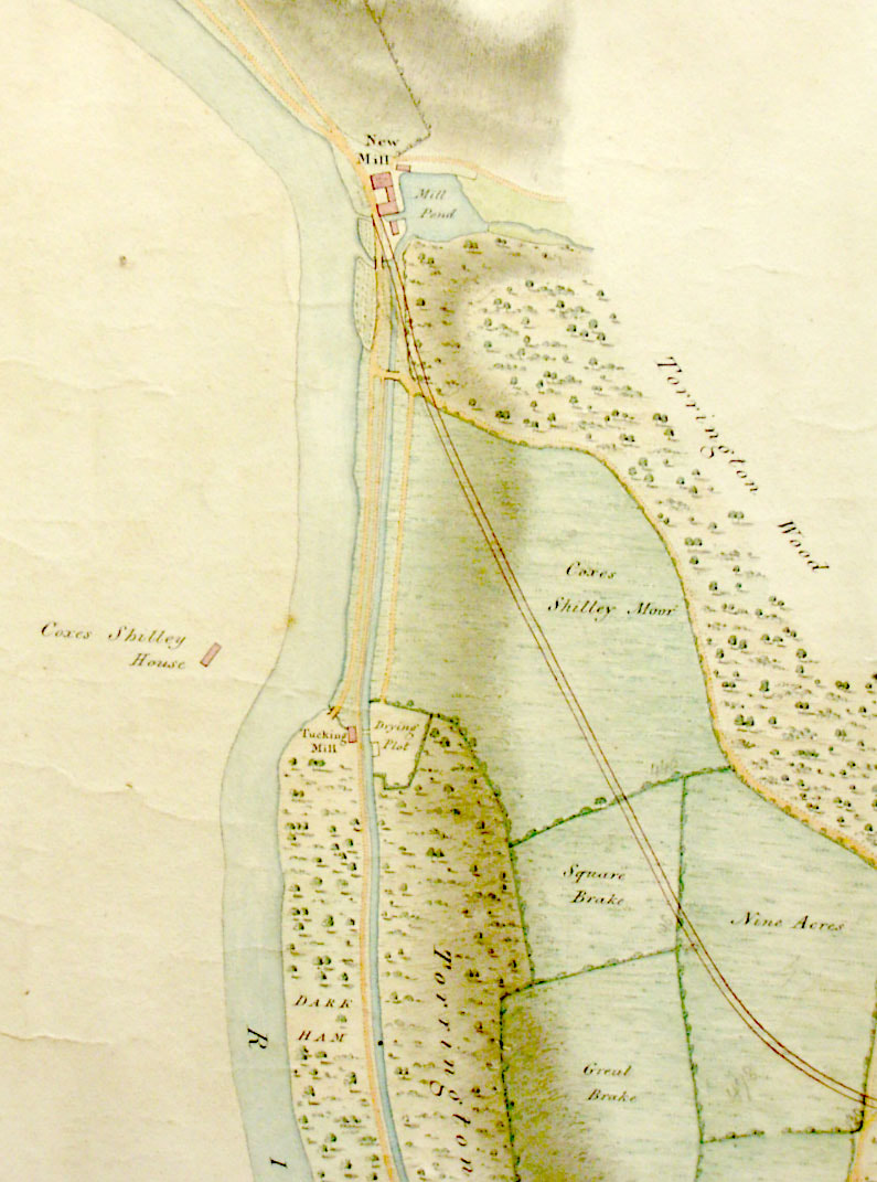
​It shows that the canal was not in existence at the time this map was drawn ca 1821. It also shows the tracks leading from the New Town Mills to the tucking mill supplied by the leat from Darkham weir. ​The lime kilns had not yet been built .

Picture
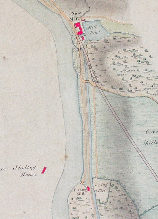
This is another version of the same map drawn by James Green in 1823 before the canal was constructed. He was asked by Devon County to plan a new road between Torrington and Beaford and this is the main purpose of the drawing. However, he shows clearly that the leat from Darkham weir is in place and being used to feed water to the new Town mills. The old Tucking Mill is clearly shown and also draws its water from this leat. There are two tracks shown between the Town mills and the Tucking Mills and evidence of the one closer to the river has been found during work at the Rosemoor basin. A bridge is also shown over the leat from the Tucking Mill to the drying  (rack) field on the opposite side.

The Tucking Mill predated new Town Mills and is probably the inspiration for the leat, but it could be speculated that this same leat originated when the old Town Mills at Taddiport were operational in the seventeenth century and took their water from this source.

The Torrington to Beaford Road  was eventually constructed with a slightly changed route taking it around the front of new Town Mills.
 
Source - Clinton Devon archives

Picture
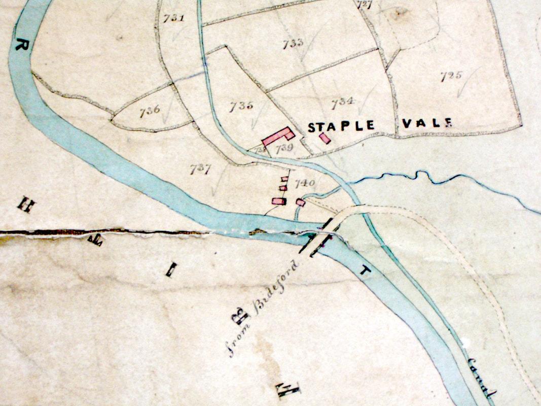
​From the Clinton archives this map shows Staple Vale before the railway, with the canal route clearly marked with interesting features such as a small aqueduct carrying the canal over the brook running through the commons. Date is not known.

Picture
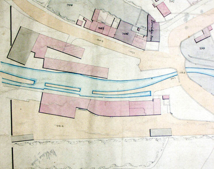
An extract from the Town Lands showing Taddiport at the peak of the canal trade. The canal company head offices were there. ca 1834

Please note that many features of the Canal are on private land and permission should be obtained before exploring these parts.
Registered as a Charity at HMRC No. ZD 09423
© Rolle Canal & Northern Devon Waterways Society 2018 - 2023
  • Home
  • Latest News & Reports
    • January
    • 2022
      • December
      • November
      • October
      • September
      • August
      • July
      • June
      • May
      • April
      • March
      • February
      • January
    • 2021
      • December
      • November
      • October
      • September
      • August
      • July
      • June
      • May
      • April
      • March
      • February
      • January
    • 2020
      • December
      • November
      • October
      • September
      • August
      • July
      • June
      • May
      • April
      • March
      • February
      • January
    • 2019
      • December
      • November
      • October
      • September
      • August
      • July
      • June
      • May
      • April
      • March
      • February
      • January
    • 2018
      • December
  • Guided Walks
  • History
  • Restoration
  • Location
  • Features
    • Sea Lock
    • Ridd Inclined Plane
    • Beam Aqueduct
    • Furzebeam
    • Staple Vale & the Rolle Road
    • New Town Mills
    • Rosemoor
    • Tucking Mill
    • Darkham Weir
  • Galleries
    • Sea Lock
    • Ridd Inclined Plane
    • Beam Aqueduct
    • Furzebeam
    • Rolle Road
    • Rosemoor and Darkham Weir
  • Other North Devon Waterways
  • Archive
    • Old Newsletters
    • Photos
    • Maps
    • Newspaper Clippings
  • Restoration of the Middle Basin at Sea Lock
  • Join the Society
  • Contacts